
In 1964, archaeologists P.L. & P.J. Carter published a paper entitled Rock Paintings from Northern Ghana. In it they detail their discovery of ancient rock art in January 1963 – the first to be documented in the newly formed nation of Ghana. I myself had stumbled across some very primitive pictographs on the Gambaga Escarpment a few miles from Nalerigu (more on that in a bit) and I was curious to see what they had found 55 years ago.
The drawings (illustrated by Carter to the right) were found right along the Ghana-Togo border on the Gambaga Escarpment (just north of the village of Tusugu or Tusik). On a rock shelter in the side of the cliffs, they found the well-preserved remains of an ancient community. There were over a dozen large terre pisé structures and twice as many smaller granary like constructions. On the walls among the cliff dwellings were four collections of the Ghanaian pictographs.
The Carter Site at Tusugu (Tusik)
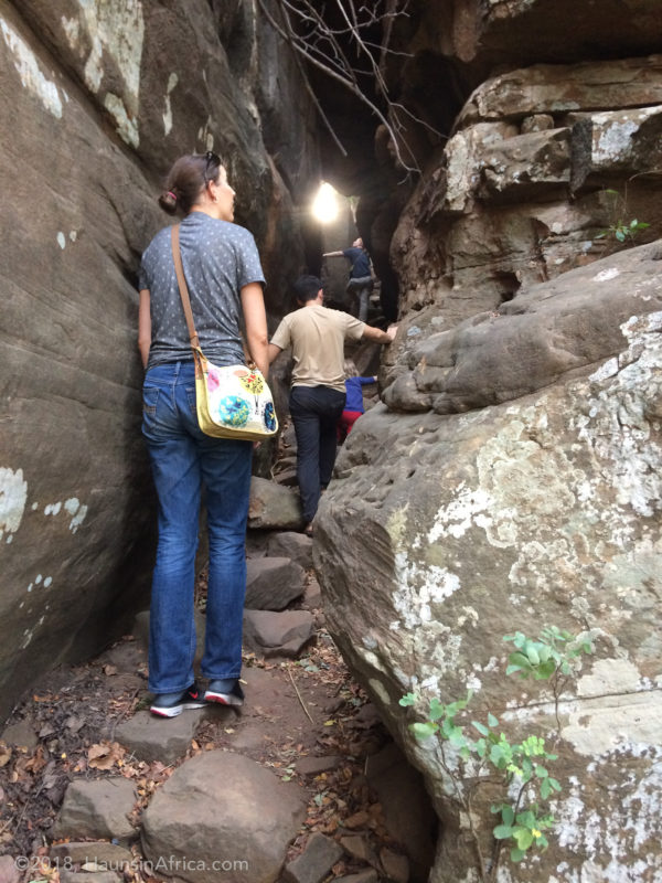
In November 2017, I rode my bike with my friend Nils to see the paintings myself. It was exhilarating to climb the cliff, push through brush and emerge into a clearing under the rock shelter where the ancient buildings stood. Seeing the rock paintings in person filled my mind with questions and imaginations about what these ancient cliff dwellers were like.
What did the drawings mean? Why did they chose to live in such an inaccessible place? How did they survive? What did they eat? What or whom did they worship?

Carter Site Cliff Dwellings Near Tusugu 
Ghana’s First Documented Rock Paintings
One line from the Carters’ 1964 paper stuck in my mind:
It is not known if similar sites occur elsewhere in the Gambaga scarp but were a thorough search made there is no reason to suppose that other sites would not be found.
That inspired me to start doing research about Ghana’s rock paintings. From what I could tell only three other sites had been documented: Gingana (East Mamprusi District), Tanfiok-Naamaa (at Jilik No.1 in Bunkpurugu-Nyakpanduri District) and Adaklu Mountain (Adaklu District)[1].

The Gingana Rock Paintings
The Gingana site was near Nalerigu and described as being accessible via a “rock tunnel” in the escarpment. It dawned on me that this was the very site I stumbled across in 2015 near the villages of Namaasim and Zarantinga! British archaeologist Dr. Timothy Insoll was the first to document it in 2004.
Dr. Insoll and his colleagues went north from Nalerigu to the relatively new settlement called Namoori. They then hiked east along the scarp to Gingana Zoori to see the rock art instead of taking the much more direct routes available through Zarantinga and Namaasim just northeast of Nalerigu. The crew walked a good 20km to the site and back, whereas I can drive my truck within 300 meters of it!
Rock “tunnel” near Namaasim at Gambaga Escarpment 
William Haun pointing to the Gingana Pictographs 
Gingana Rock Paintings in the Gambaga Escarpment
God Writing
These cool discoveries really got me pumped about finding more rock paintings. The Gingana and Carter sites are 20 miles apart (as the crow flies) – surely there are more rock paintings waiting to be discovered along the Gambaga Escarpment between them.
Locals from Namaasim always called the Gingana pictographs Nawunsɔppu or “God writing” when I asked about them. They told me “our ancestors came and saw them.” So I started asking any hunter I encountered if they knew of any other Nawunsɔppu.
A New Rock Art Discovery at Kpatritinga
One day I took my friend Ben Stanton to see the Gingana rock paintings and we met a hunter named Isahakku there. He had just killed a beautiful Violet Turaco and a trapped a Nile Monitor down by the White Volta. Isahakku told me that there was some more “God writing” over by his village of Kpatritinga (Kpatiritiŋŋa literally “Baboon Land” in Mampruli). We followed him there (it’s the first village on the main road east of Sakogu) and he led us out through the farms north of the community.
He first brought us to a large, flat boulder resting impressively on three small points. On the north underside of the rock were some rock paintings that formed basic lines, arrows and crosses.
Then he took us to a farm right at the edge of the scarp and overlooking the old colonial road from Sakogu to Sinebaga. There under a massive rock shelter was a farmer cooking beans on an open fire. On the rock hanging above him were dozens of pictographs – geometric shapes, lizards, men, men on horses, scorpions, and more. A huge section of the painted rock is obscured by soot from decades (centuries?) of farmers cooking below it.

Boulder with Simple Rock Paintings 
Boulder with Simple Rock Paintings 
Kpatritinga Farmers’ Shelter 
Kpatritinga Rock Paintings 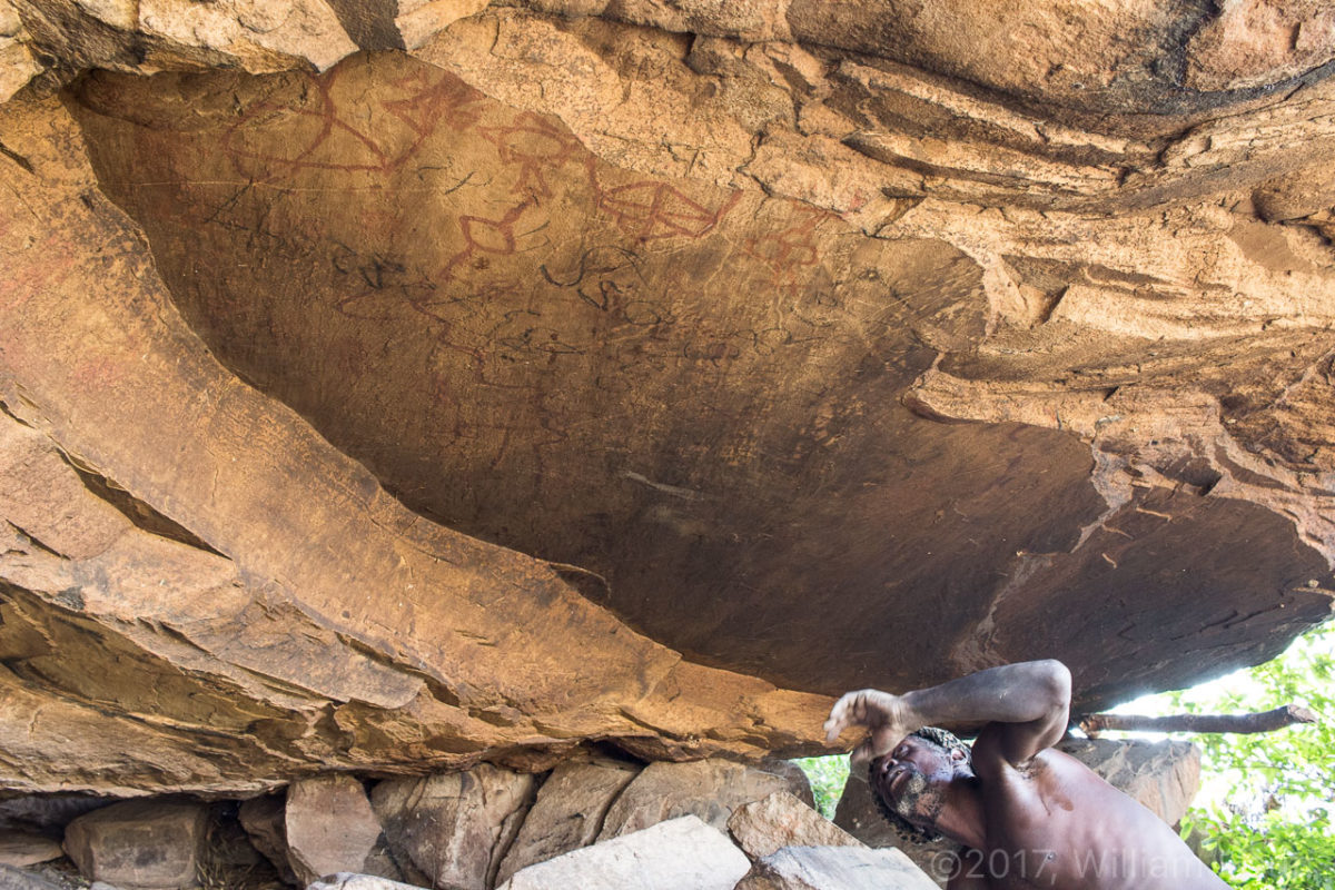
Kpatritinga Rock Paintings Covered by Smoke 
The Guardian of the Paintings
I was so excited to be the first to photograph these and report them to the Ghana Museum and Monuments Board (GMMB). After sending them an email with my story, images, and GPS coordinates they promptly wrote me back. Senior Curator Mahmoud Malik Saako thanked me for the information and told me that he would have the next field trip to my area visit the site with me. It was really encouraging to know that the GMMB is committed to documenting and preserving Ghana’s important cultural and historical sites.
As a result, I am now looking forward to the day when I can meet Mr. Saako and GMMB colleagues in person and take them to yet another important historical site in Mamprugu! To be continued…